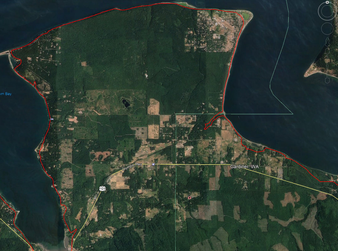
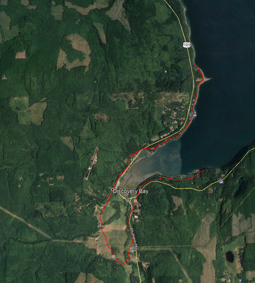
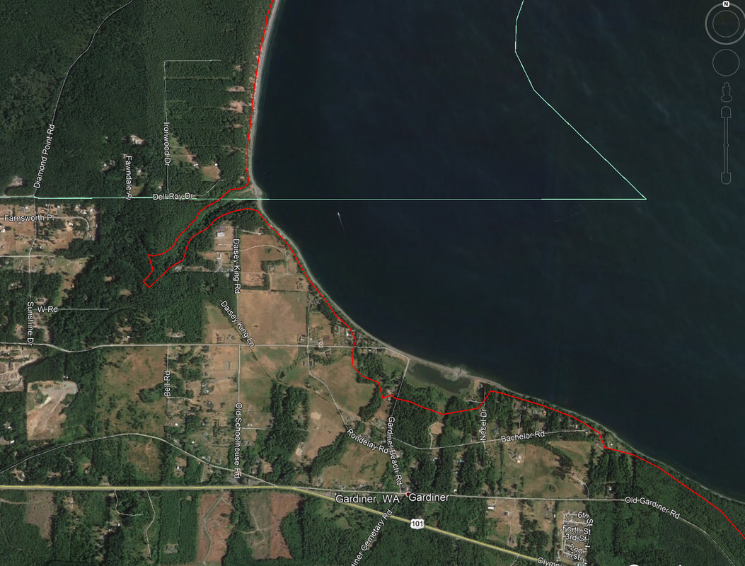
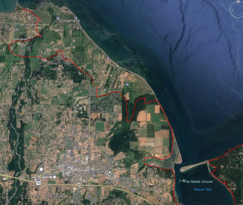
Tsunami Zone Maps
The maps below show the (approximate) 50' elevation lines for Sequim Bay, Diamond Point, and Discovery Bay, as well as a more zoomed-in map for Gardiner and a view of the Sequim Prairie. They were done using the features of Google Earth. They should be accurate enough for folks to use when the warning horns tell them to get above the 50' line for safety.
Thank you Robert M. for the information.
Thank you Robert M. for the information.
Please click on image for full sized view